
This is a new series of posts when I set out my thoughts on a broader subject. I am moving from mixing colours to something more directly to do with warfare: terrain. Everybody knows that terrain is critical to the course of battles – but representing it on the tabletop, or allowing for its effect in rules, presents particular challenges. In these posts I want to do two things: consider what these terrain effects are – based the landscape as it was historically, rather than the very different place we typically see today. The second is to consider how to represent these effects on the tabletop. In this I will have a strong bias towards Europe, and the eras that I play, from Horse and Musket to World War 2.
I will start by looking at hills – or relief. At least this aspect of terrain is virtually timeless. The shape of hills has changed little over time. Their effect on warfare has changed though. In ancient times, when a lot of warfare came to big shoving matches between close packed bodies of men with shields, with few casualties until one side broke, the physical effects of gravity were clearly important. This would have diminished once firearms started to dominate, and physical contact became less important; contemporary accounts still talk of the tiring effect of marching uphill towards the enemy, but it is harder to discern whether this had much effect on actual combat, unless combined with disordering terrain. The effect of hills on line of sight started to become much more important: hills could block the path of a cannon shot. And when modern howitzers and mortars allowed the indirect fire over the hilltops, hills became critical to observing and directing such fire. In the 1943 battles in the Mediterranean that I am studying this was often central to the way the armies fought: the advancing side had to capture the commanding heights, which could render defensive positions untenable. In addition steep hills were an obstacle to the passage of troops and especially vehicles. The biggest battle in Italy (barring perhaps Anzio – though this was fought largely on the flat) was centred on a mountain: Monte Cassino.
The shape of things
What about the physical characteristics of hills? Firstly the shape. Here the biggest challenge for wargamers is that they rarely conform to nice isolated blobs on the landscape. The whole ground is shaped in features that can extend for miles. In fact there is rarely such a thing as completely flat ground: and it doesn’t take much of a fold in the landscape to affect what you can see. If you take a walk in the countryside you may be surprised how short it your line of sight – unless you are above the features you are observing. Visibility on level ground is in practice restricted by small folds, to say nothing of trees, hedges, walls and buildings. When visiting the battlefields outside Ypres, the ground at first seemed to be flat and nearly featureless. But standing where the British would have stood, we were looking at a German controlled ridge that was considered to be of great tactical importance.
Two key points arise here: first, don’t think about “hills” so much as “relief” – shape of the whole landscape. And second, height is a relative concept. It doesn’t matter how high you are in absolute terms – it matters whether you are higher than what you are trying to observe. Or lower. If you can see, you can be seen. If you are descending a hillside you are exposed to the whole landscape in front of you. A slope neutralises the effect of other terrain obstacles.
Linked to shape is steepness, and this can be considered next to ruggedness – or how broken the terrain surface is. Slopes are mostly gentle outside hilly regions, but occasional steep slopes can surprise. The countryside near Devizes is mostly gentle and rolling – but Roundway Down, the site of a Civil War clash, stands out as a low hill when approached from West, as the Parliamentary army did, but conceals a 100m precipitous drop, enhanced by Iron Age fortifications, that caused havoc to their cavalry when forced onto it. In hilly areas steep slopes become more common, of course, as well as rocky and other rugged terrain which hinder close order formations and vehicles. When thinking about all this, I conflate slopes and other ruggedness into a single concept of “difficult terrain”.


Incidentally there is an interesting debate about horses and hills. In traditional rules, cavalry would get a +1 for charging downhill – and you would station cavalry units on hills. People that actually ride horses (not me, I must add) find this highly dubious. Quadrupeds like horses find it easier to go up hills (though exhausting) than down. At Rolica in 1808 one of the British officers ascended quite a steep hill on horseback and got into trouble because the horse ran ahead of his men. One rule-writer went as far as not allowing cavalry to charge downhill, or giving it a disadvantage – though this was usually house-ruled away, apparently. It would be interesting to know if anybody has done any systematic research on cavalry and hills.
On the table
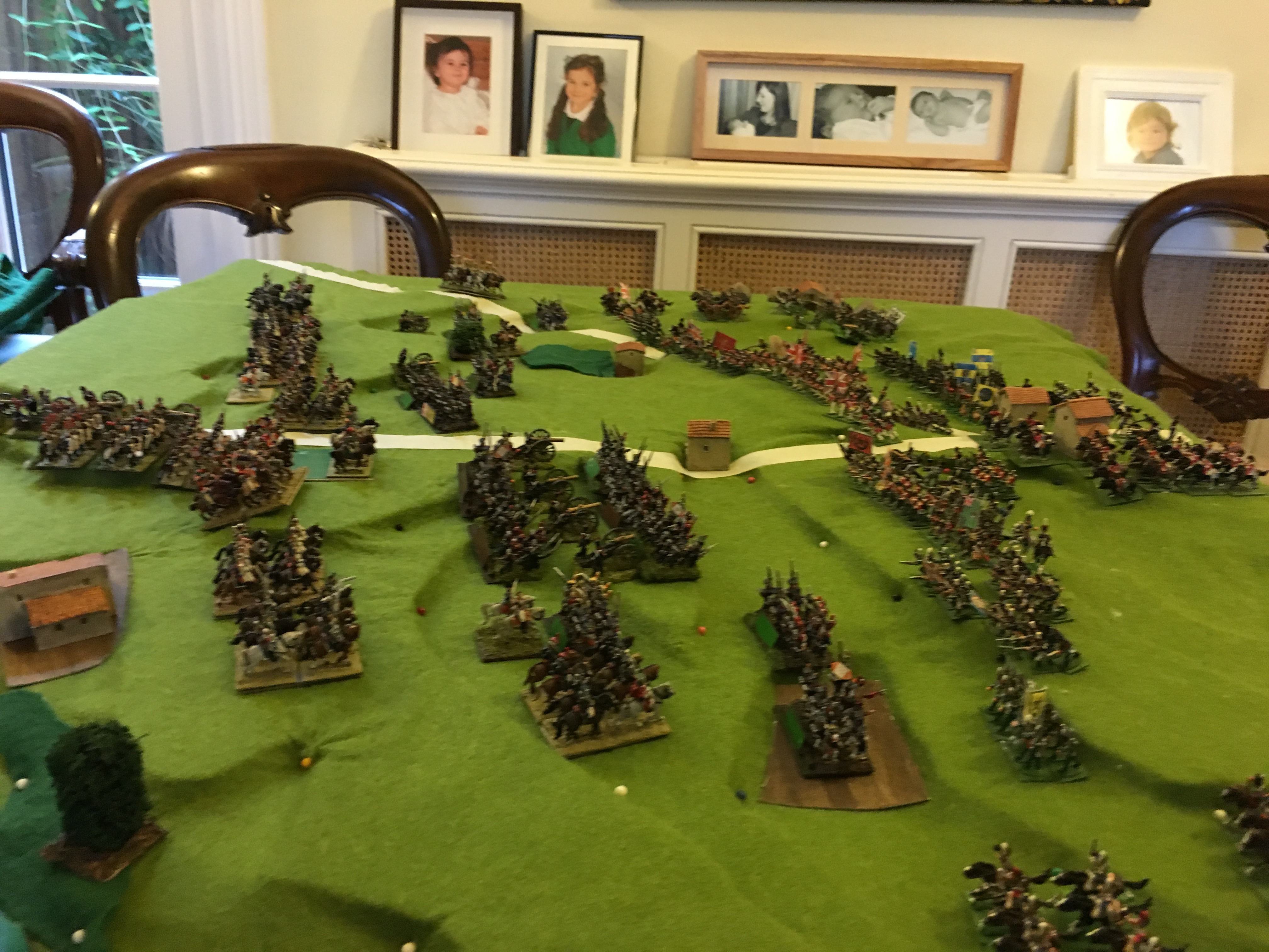
How to represent this on the tabletop? The best way is to sculpt terrain, directly modelling the features of relief. But this is a huge investment, which usually cannot be re-used for other battles. This is appropriate for show games rather than more ordinary fare. There are three broad approaches: avoidance, separate hills, and cloth over contours.
Avoidance is a common approach. I see a lot of games without any representation of relief at all. This can be justified if you think that relief did not play a significant role. If historical accounts don’t mention hills, they probably aren’t important. We have an idea that a lot of ancient battles were fought on flat, open ground because controlling armies in other terrain, or enticing enemies into battle, led to this. I’m no expert on ancient battles, so I can’t really comment. The exact location of battles is usually unknown anyway, so going back to the historical ground isn’t an option. Indeed when setting up setting up scenarios using historical forces but indeterminate locations, you can simply design out the hills. This seems to be what happens with many skirmish games. But there can be a stronger justification, especially with the smaller games: other terrain features can trump the effects of relief. The main effect of hills is to block line of sight. But if there are plenty of other obstacles – forests or buildings – the additional effect of hills is pretty limited. This would apply if refighting Shiloh, say, or parts of Stalingrad.
A short step from this is to use the traditional approach of placing separate hills on the terrain – sculpted or contoured, on top of the mat or under it. If the historical account mentions a hill, you can just find one from your box terrain and plonk it on the table. In fictional scenarios you can place them where you like to present particular tactical opportunities or problems. In many cases it is possible to achieve the tactical impact of more complex relief this way.

But very often this will not do. The features are simply too big or too complex to be represented by some blobby hills. Waterloo is a case in point if you are trying to recreate the whole battle. The best solution, I think, is to try and resolve the terrain into a small number of contours – two above the base level is often all that is required. I have found this to be perfectly feasible, but putting it together on the basis of a contour map or other information can do your head in. It is not a question of precision, it is judging what is and isn’t important. I love this kind of doing my head in, though, and I have found that attempting it always adds profoundly to my understanding of the terrain and the battle. With a bit of luck you can find that somebody has done this for you. Bruce Weigle does this in his scenario books for the Bismarck era wars, even though he usually goes for the full sculpt himself (as in the lead picture). Chris Pringle has done it for his Bloody Big Battles rules.

What you then need to do is recreate this contoured terrain. This can be done in some appropriate material and directly painted, and used as the playing surface. A friend did this for me for my bicentennial game of Vitoria – using some cardboard type insulating board – though he said that it proved difficult material to work with and he wouldn’t recommend it. Much easier to use styrofoam board (high or low density), and place a cloth on top of it. The under-layer can be as bitty and messy as you like – though it’s a good idea to tape it to the table before placing the cloth on top. You sometimes need pins to get the cloth to lie in the right way. Alas the foam board is unlikely to be usable for other battles. You either need to throw it out afterwards or store for a future rerun of the same game. If the latter you need to mark the pieces so you can figure out how they fit together. Relying on memory won’t be enough.
In the rules
Mostly the treatment of hills in rules is quite straightforward. They block line of sight. Some slopes may be steep or rough enough to constitute difficult terrain. Being uphill of an opponent may give a tactical advantage in combat. Or not. Still, there are a small number of issues which I think can be neglected, or which are difficult in practice.
In the first category comes the effect on visibility. Being uphill does not just help visibility, it transforms it. Visibility along the same level is usually quite limited – not least by small folds in the terrain that it is too hard to represent on the table. Small gains in height, such as from a first floor window, or railway embankment, can transform the view. This needs to be allowed for, especially in 20th century games. On those country walks, test yourself to see how far you can actually see without the object being on a higher or lower level. Often not much more than a few hundred metres. This is not just important for directing the fire of longer-range weapons, but it is important for the situational awareness of commanders, including in earlier eras. Whether or not this justifies a ” +1 for vantage point” in command friction tests is another matter: you can have too many modifiers. The important point is that control of vantage points confers a tactical advantage which makes them worth fighting for – and that can be reflected in the scenario set-up.
One potential complexity is the question of dead ground. This applies where some hills are high enough to overlook other blocking terrain. This is sometimes ignored, or sometimes you get very elaborate tables. I’m very much in the keep it simple camp – and probably scenario specific rules are the best way to go. A fixed distance of dead ground is easier to live with than having to refer back to a table.
Then there is the question of rounded hills and ridge lines. This is a particular problem for contoured terrain – such as I have just recommended above. A good general rule is that units on the same contour are treated in the same way as those on “flat” terrain, and can see through any ridge line. But troops on a lower level can see units in front of the ridge line but not behind it. Likewise troops behind a ridge line can’t see units on a lower level across it. The ridge line can be marked in some way, or you can use a simple half-way rule. Or if that doesn’t feel right, units need to be within a certain distance of a ridge line to see through it. Something similar applies to plateaux. The ability to see beyond the edge into valleys or other lower ground is limited unless you are close to the edge.
Another issue that can vex people is the ability of cannon to fire overhead in the Horse and Musket era. Some people, like the great rules designer Sam Mustafa, say that this didn’t happen – or not often enough for it to be important. I disagree – based on my reading of the Battle of Ligny in 1815 in particular – where I think both the French and Prussians used overhead fire, and this had important consequences for the conduct of the battle. It was one way the French were able to isolate the village of Ligny, hindering the ability of the Prussians to withdraw troops to regroup (which the French were able to do very successfully) – and the ability of Prussians to reinforce without running the gauntlet of cannon fire. Howitzers had a better ability to fire overhead, but they were a far cry from their more modern namesakes – their main advantage was in the use of explosive ammunition.
Conclusion
The shape of the landscape can be tricky to represent, but it is important if you seek a historical understanding of the battle you are recreating. It can provide important insights. At Waterloo the shape of the terrain is critical to understanding the battles for Hougoumont and La Haye Sainte. They are in hollows and/or screened by woods. They aren’t so easy to target with artillery – though the French eventually managed to converge some howitzers to attack Hougoumont and set it on fire, not a tactic that most wargames rules cater for.
Next time: Woods

Leave a Reply